

定價
:NT$ 3105 元無庫存,下單後進貨(到貨天數約30-45天)
可得紅利積點:93 點
相關商品
商品簡介
作者簡介
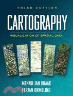
商品簡介
"This up-to-date book reflects the latest trends in dynamic mapping and geovisualization. Kraak and Ormeling present a through, current discussion of principles and best practies for visualization of spatial data. They explain cartographic theory and provide examples of relevant applications. This is a valuable resource for students new to using GIS for spatial data visualization, as well as for more advanced cartographers interested in furthering their knowledge of principles of dynamic geovisualization design."---Sarah Battersby, Department of Geography, University of South Carolina
"The third edition of this popular text adds exciting new material, reflecting significant recent changes in cartography. These include the rapid growth of personal location-based services, the launch of Google Earth and Google Maps and their competitors, and the advances that have been made in the science of geovisualization. Maps are now a standard part of everyone's digital world and essential accessories to modern life. This book will be invaluable as a classroom text and professional resource."---Michael F. Goodchild, Department of Geography, University of California, Santa Barbara
"This text presents technology and mapping concepts as one integral whole to help students navigate the complex world of contemporary multimedia. Kraak and Ormeling are experienced practitioners who go beyond cartographic basics to explain the fundamentals of spatial data serving online, spatial analysis, and animation. This is an excellent text for an upper-level class in geovisualization or multimedia."---Margaret W. Pearce, Department of Geography, University of Kansas
"The authors have been careful to present to the reader not only a basic understanding of what cartography is but how geospatial data and maps are so integral to many of the disciplines that utilize specific technologies, such as GIS and the WWW, to communicate information....Most chapters include as many pages of graphics as they do text, which is a great benefit to the novice reader."---Applied Spatial Analysis and Policy
Integrating cutting-edge technology with traditional cartographic principles, this text provides a framework for effectively visualizing and analyzing geospatial data. It gives students critical concepts and methods for harnessing the enormous amount of geospatial data available on the Internet and creating maps that can support real-world decision making. The third edition incorporates current developments in scientific and information visualization, multimedia, animation, virtual reality, and exploratory data analysis. The writing style is straightforward, clear, and accessible. Illustrated throughout with highly instructive diagrams and sample maps, the book includes 58 color plates.
作者簡介
Menno-Jan Kraak is Professor of Geovisualization at the Faculty of Geoinformation Science and Earth Observation, University of Twente, The Netherlands.
Ferjan Ormeling is Professor of Cartography at the Faculty of Geosciences at Utrecht University, The Netherlands.
Ferjan Ormeling is Professor of Cartography at the Faculty of Geosciences at Utrecht University, The Netherlands.


您曾經瀏覽過的商品

購物須知
外文書商品之書封,為出版社提供之樣本。實際出貨商品,以出版社所提供之現有版本為主。部份書籍,因出版社供應狀況特殊,匯率將依實際狀況做調整。
無庫存之商品,在您完成訂單程序之後,將以空運的方式為你下單調貨。為了縮短等待的時間,建議您將外文書與其他商品分開下單,以獲得最快的取貨速度,平均調貨時間為1~2個月。
為了保護您的權益,「三民網路書店」提供會員七日商品鑑賞期(收到商品為起始日)。
若要辦理退貨,請在商品鑑賞期內寄回,且商品必須是全新狀態與完整包裝(商品、附件、發票、隨貨贈品等)否則恕不接受退貨。