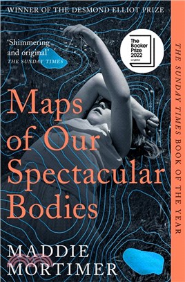
2022 NomineeDesmond Elliott PrizeThe Goldsmiths PrizeLonglisted for the Booker PrizeWinner of the Desmond Elliott PrizeShortlisted for the Goldsmiths PrizeLonglisted for the Dylan Thomas Prize‘Original, memorable, shimmering’ - Sarah MossLia has only one child, Iris; her magical, awkward, endlessly creative daughter who has just entered the battleground of her teenage years. Lia and Iris have always been close, but there is a war playing out inside Lia’s body, too, and everything is about to change. As she confronts what might be the end, memories of her own childhood and a passionate love affair come rushing into her present, unearthing buried secrets and her family’s deepest fears. But Lia hopes: for more time, for more love, for more Iris.Dancing between voices within Lia’s body and without, flitting back and forth in time, this sweeping, dazzling story of a life and what it is to let go marks the arrival of an extraordinary novelist.'Restlessly inventive . . . delicate and persuasi
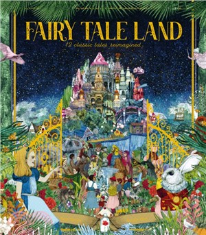
Fairy Tale Land opens the gates to the magical land where all the fairy tale characters live. Get lost in this visually stunning, oversized gift book that features all the well-loved stories, and immerse yourself in their enchanting world! The tales are expertly retold, perfect for bedtime, and each story is followed with an exquisitely illustrated, detailed map of its neighbourhood. You can drop into Hansel and Gretel's cottage, explore the palace from Beauty and the Beast, and dive deep under the sea with the Little Mermaid.What wonderful things can you find in your favourites' homes?Beautiful, stylish and vibrant illustrations adorn each page, as the magical text transports readers to faraway lands of mystery, fantasy and magic. Stunning full-page artworks and the detailed maps of the lands in which these stories take place mean this title will be lovingly pored over time and time again. The stories include: The Little MermaidThe NutcrackerCinderellaThe Jungle BookThe Wizard of OzHa
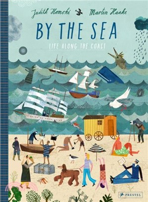
Brimming with illustrations and information, this coast-to-coast journey through time and across continents introduces young readers to the historical and cultural importance of the world's seashores. Coasts have always been the starting point of discovery- whether by explorers searching for new lands or children sifting through the sand for beautiful shells. This trip around the world's oceans provides hours of fun and learning in a series of highly detailed double-page spreads that look at every aspect of critical coastal habitats, including the ebb and flow of tides; life in a coastal settlement; artistic depictions of seashores; native animals and plants; the whaling industry; tourism; and climate change.The book also provides a Twenty-First-Century corrective to Western-centric narratives about exploration and colonialism. Interspersed throughout are meticulously detailed maps of the world's largest oceans with historic events, figures and scientific facts highlighted. As fun as i
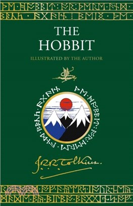
For the first time ever, a special enhanced edition of the enchanting prelude to The Lord of the Rings, illustrated throughout with over 50 sketches, drawings, paintings and maps by J. R. R.Tolkien himself and with the complete text printed in two colours. Bilbo Baggins is a hobbit who enjoys a comfortable, unambitious life, rarely travelling further than the pantry of his hobbit-hole in Bag End. But his contentment is disturbed when the wizard, Gandalf, and a company of thirteen dwarves arrive on his doorstep one day to whisk him away on an unexpected journey 'there and back again'.They have a plot to raid the treasure hoard of Smaug the Magnificent, a large and very dangerous dragon... Written for J.R.R. Tolkien's own children, The Hobbit was published on 21 September 1937.With a beautiful cover design, a handful of black & white drawings and two maps by the author himself, the book became an instant success and was reprinted shortly afterwards with five colour plates. Tolkien's
Maps & Destinations celebrates the large and small events of life through story, myth, and the contemplation of other works of art. Deep in the phenomenology of time and place, the poems are as ev
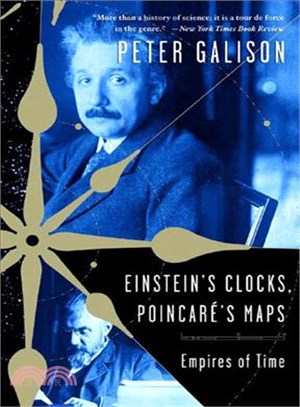
A dramatic new account of the parallel quests to harness time that culminated in the revolutionary science of relativity, Einstein's Clocks, PoincarAc's Maps is "part history, part science, part adve
Discover the fun facts about the world and become a master of geography with this interactive trivia book from Jeopardy! champ and New York Times bestselling author Ken Jennings.With this Junior Genius Guide to maps and geography, you’ll become an expert and wow your friends and teachers with clever facts: Did you know that the biggest desert in the world is actually covered in snow? Or that Christopher Columbus wasn’t the first to think that the Earth was round? With great illustrations, cool trivia, and fun quizzes to test your knowledge, this guide will have you on your way to whiz-kid status in no time!
fMRI is a very popular method for researchers and clinicians to image human brain activity in response to given mental tasks. This book presents a comprehensive review of the methods for computing activity maps, while providing an intuitive and mathematical outline of how each method works. The approaches include statistical parametric maps (SPM), hemodynamic response modeling and deconvolution, Bayesian, Fourier and nonparametric methods. The newest activity maps provide information on regional connectivity and include principal and independent component analysis, crisp and fuzzy clustering, structural equation modeling, and dynamic causal modeling. Preprocessing and experimental design issues are discussed with references made to the software available for implementing the various methods. Aimed at graduate students and researchers, it will appeal to anyone with an interest in fMRI and who is looking to expand their perspectives of this technique.
First published in 1977, this book shows the positions of the major continental areas during the past 220 million years as four series of computer-drawn maps. The maps have been drawn for the present day, 10 and 20 million years ago, then at 20-million-year intervals back to 220 million years. All the maps are based on quantitative geophysical or topographic information: paleomagnetic pole positions, ocean floor magnetic anomalies, and best fits of the continental margins. Mercator, north polar and south polar sterographic, and Lambert equal-area maps of each selected time interval are provided. Many interesting problems in the Earth Sciences are global; they need to be seen in a proper global setting. The maps provide such a framework on which a very wide range of geological information may be plotted. Problems in fields as widely separated as palenontology, stratigraphy, geochemistry and tectonics may usefully be displayed on these maps.